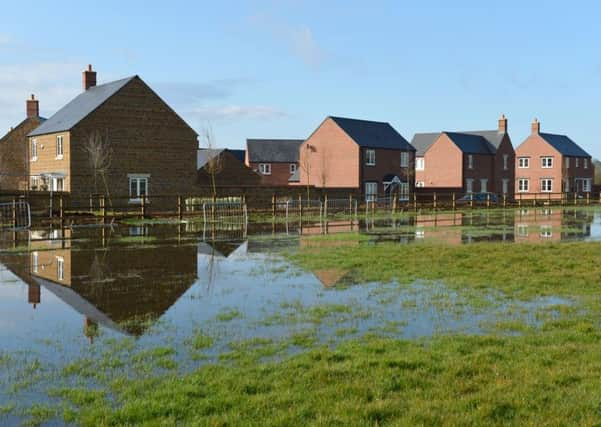
Hook Norton villagers say '˜We told you so' after new housing development is threatened by flood


The fight against 70 homes that will make up Bourne View off Bourne Lane went to appeal where an inspector dismissed the village’s concerns.
Parish council chairman Emma Kane, who prepared the community’s objections to the estate of three- and four-bedroomed houses, said she was not surprised at the flooding.
Advertisement
Hide AdAdvertisement
Hide Ad“There was massive objection to this estate. We knew and raised concerns about the area having a high water table which tellingly runs down to a road called Watery Lane,” she said.
“There was a pond on the site. And the historic name of the area, Bourne, is Anglo Saxon for ‘stream’. This flooding comes as no surprise at all. Our infrastructure is not designed to take all this rain runoff. The flood waters of late have been as high as the village has ever seen and with all this building run-off is affecting areas half a mile away. There is genuine concern that the development will increase the flood and sewage pollution risks for other homes.”
Hook Norton has had a 38-home estate built at Station Road and is taking Bourne View in two phases. Having satisfied its five-year housing supply in the new local plan, Cherwell District Council is taking plans for a third large development for 53 homes off Sibford Road to the High Court in a bid to get it reversed.
A Taylor Wimpey spokesperson said: “Our Bourne View development is situated adjacent to farming land which, following the heavy rainfall at the beginning of March, was subject to flooding, along with other fields in the local vicinity.
Advertisement
Hide AdAdvertisement
Hide Ad“The flooding occurred on the neighbouring field in an existing low spot that is outside of our development’s legal boundary. However, given the close proximity of this farming land, Bourne View was unfortunately affected by the flood.
“Our development itself suffered no flooding issues from rain water collecting within the site, however we are committed to inhibiting any future flood events occurring at Bourne View. Therefore, we are working closely with our drainage consultants united with the support from the owner of the farming land to mitigate all future risk.”
Nigel Slade, of Bourne Lane, said one of the newly built houses had been sandbagged against the flood to prevent water entering the property.
In its original opposition to the development the parish council said: “The flood risk analysis appears to consider only the risk of the site itself flooding. The addition of a “balancing pond” to moderate flood risk would suggest that more run off is expected. The area of land is not well drained naturally and it currently causes flooding issues for properties along The Bourne and the water eventually finds its way down the natural watercourse, Watery Lane, at the bottom of which are several very old properties that regularly suffer flooding. Although the measures proposed could be effective, there is a genuine concern in the village that the development will increase the flood and sewage pollution risks for other homes.”