
Met Office issues amber weather warning for extreme heat in Banbury tomorrow (Thursday)
The Met Office has issued an amber warning for extreme heat for Banbury on Thursday, August 13.
A large part of the south east and central England, including Banbury, is set to experience scorching temperatures this week as another heatwave sweeps across the country.
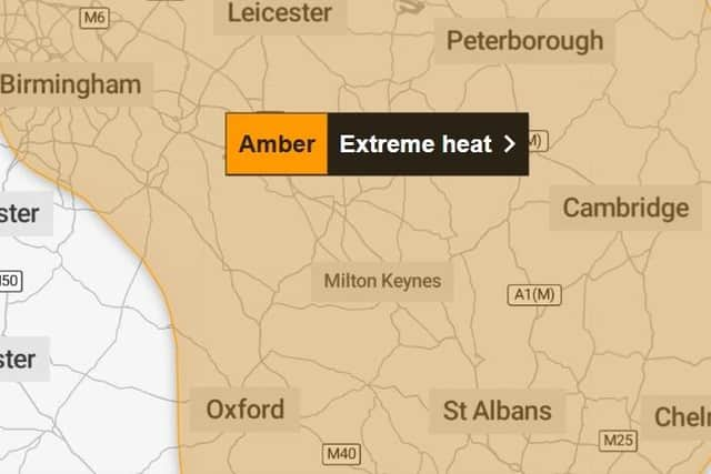

The Met Office has issued an amber warning for “extreme heat” from 9am until just before midnight on Thursday.
Temperatures in Banbury are forecast to reach 36°C on Thursday afternoon, while some parts of the country could see highs of 38°C.
The heat is expected to ease by Friday, with temperatures in Banbury forecast to reach around 29°C.
People are advised to drink plenty of fluids, stay out of the sun, avoid exercise between 11am and 3pm and close curtains in rooms facing the sun.
A Met Office spokesperson said: “If you are going out, take water with you, stay in the shade, wear sunscreen and a wide-brimmed hat.
“Give yourself the best chance of avoiding delays by checking road conditions if driving, or bus and train timetables, amending your travel plans if necessary.
“If using public transport, there are many simple things you can do to keep yourself safe; carry water with you, take a small hand-held battery-powered fan, and if you feel unwell, get off at the next stop for some fresh air.
“Dress in light fabrics and colours to help stay cooler, and keep an eye on fellow passengers for signs they may be struggling.”
Residents are also urged to check on vulnerable people, including older people, those with underlying conditions and people who live alone, who may need help staying cool and hydrated.
Met Office chief forecaster Chris Bulmer said: “While the peak heat will be more short-lived than recent heatwaves, temperatures widely into the mid-30s Celsius on Thursday bring the potential for impacts for some, which is why a Met Office warning has been issued.
“High pressure is now becoming dominant and temperatures will build day by day. Southerly and southeasterly winds will also tap into the hot conditions over Europe, which helps develop this further notable heat in what has been a hot and dry summer so far for many in the south of the UK.”
For more information visit: https://weather.metoffice.gov.uk/warnings-and-advice/uk-warnings#?